DJI Agras T100 Large-Scale Agricultural Drone: Comprehensive Analysis of Heavy-Lift Capacity, Rapid Battery Swapping, and Smart Farming Integration
Global DJI Agras T100 Agricultural Review

DJI Agras T100 Large-Scale Agricultural Drone: Comprehensive Analysis of Heavy-Lift Capacity, Rapid Battery Swapping, and Smart Farming Integration

Redefining the boundaries of ultra-scale precision agriculture, the DJI Agras T100 emerges as the definitive flagship solution for massive commercial farming syndicates and professional agricultural service contractors. Engineered to address the daunting demands of thousands of hectares of contiguous crop fields, the T100 combines a massive 100-kilogram operational payload capacity with advanced AI flight algorithms, setting a new global standard for chemical application efficiency. The platform is specifically designed to eliminate traditional logistical bottlenecks in rural farming by merging large-volume liquid spraying and granular spreading into a single, highly adaptable airframe that maximizes seasonal return on investment. From a technical and mechanical design standpoint, the T100 features a ruggedized, folding coaxial multi-rotor structure built to withstand corrosive agricultural chemicals and extreme environmental exposure, certified with an IP67 waterproof rating. The integrated spraying system utilizes high-flow dual centrifugal atomizing nozzles capable of delivering precise droplet distributions across adjustable swaths, ensuring optimal canopy penetration and zero chemical drift. To sustain continuous high-output operations, the aircraft is powered by an innovative DB2160 battery ecosystem paired with a rapid-charge station that achieves a complete power replenishment in just nine minutes. Operating a disciplined multi-battery rotation enables farm crews to maintain near-zero idle downtime, sustaining remarkable coverage rates exceeding 70 acres per hour across a standard workday. The commercial marketplace supporting large-scale agricultural automation is experiencing unprecedented expansion, driven by acute rural labor shortages and the global push toward sustainable, data-driven farming practices. Agribusiness analysts evaluate heavy-lift platforms like the T100 as revolutionary capital assets that dramatically reduce chemical waste, optimize water conservation, and lower overall operational expenses. Equipment manufacturers and regional distributors report record-breaking pre-order adoption rates as corporate farming entities transition away from traditional ground-rig sprayers in favor of autonomous aerial fleets. in parallel with continuous hardware hardening, software engineering teams maintain robust cloud-based mission planning platforms that sync seamlessly with multi-spectral crop health maps for variable-rate applications. Developer commitment to automated safety protocols incorporates Safety System 3.0, combining forward-and-backward LiDAR, millimeter-wave radar, and multi-angle vision sensors to ensure foolproof obstacle detection even in dense fog or low-light conditions. Compliance officers verify that all regional pesticide application standards and aviation safety directives comply strictly with international agricultural laws. For farming enterprises aiming to maximize crop yields while minimizing environmental impacts, deploying the DJI Agras T100 delivers an unbeatable operational advantage. Industry experts consistently recommend establishing dedicated field-side generator stations to support continuous rapid-charging cycles during peak seasonal spraying windows. (Disclaimer: For reference only)
DJI FlyCart 30 Heavy-Duty Logistics Drone: Comprehensive Review of Mountainous Cargo Transport, Winch Mechanisms, and Infrastructure Supply Chains

DJI FlyCart 30 Heavy-Duty Logistics Drone: Comprehensive Review of Mountainous Cargo Transport, Winch Mechanisms, and Infrastructure Supply Chains

Transforming the logistics landscape in extreme topographical environments, the DJI FlyCart 30 establishes a new paradigm for heavy-duty aerial cargo transport and utility supply chain management. Designed to conquer challenging terrains such as high mountain ridges, dense forests, offshore energy platforms, and disaster-stricken zones where traditional ground transport is unfeasible or entirely blocked, the FlyCart 30 bridges the critical gap between warehousing hubs and remote delivery points. By replacing hazardous multi-hour ground treks with swift, direct point-to-point aerial transit, the platform safeguards supply lines and revolutionizes emergency relief operations. From a technical and mechanical design standpoint, the aircraft features a high-strength four-axis, eight-propeller coaxial configuration engineered for exceptional wind resistance and flight stability under heavy loads. It offers a dual-mode payload architecture: a spacious 70-liter cargo case equipped with automatic weighing and center-of-gravity balancing sensors, and an industrial-grade winch system featuring a 20-meter steel cable for precise cargo placement in confined areas without landing zones. Powered by dual high-capacity batteries, the aircraft delivers impressive operational ranges and maintains robust flight performance while carrying up to 30 kilograms of payload. Advanced dual-radar obstacle sensing and an integrated parachute system ensure maximum flight safety across unpredictable environments. The commercial marketplace surrounding industrial aerial logistics and last-mile infrastructure supply is experiencing explosive growth, with utility companies, construction firms, and emergency response teams aggressively integrating cargo drones into daily operations. Financial market analysts project multi-billion-dollar valuations for commercial aerial freight sectors, noting that automated cargo transport drastically reduces project completion timelines and eliminates human risk in treacherous terrain. in parallel with ongoing software refinement, backend engineering teams maintain encrypted telemetry and fleet management networks that allow remote supervisors to monitor cargo routes, battery health, and winch status in real time. Developer responsiveness to industrial user feedback ensures regular optimization for automated return-to-home pathways and emergency fail-safes. Compliance officers verify that civil aviation authority regulations regarding heavy-payload commercial transport adhere strictly to international airspace laws. For industrial enterprises managing remote supply chains or infrastructure maintenance, investing in the DJI FlyCart 30 offers a highly reliable, cost-effective transport solution. Industry experts consistently recommend mapping precise GPS landing corridors and pre-clearing winch drop zones to ensure maximum operational safety during high-frequency material delivery cycles. (Disclaimer: For reference only)
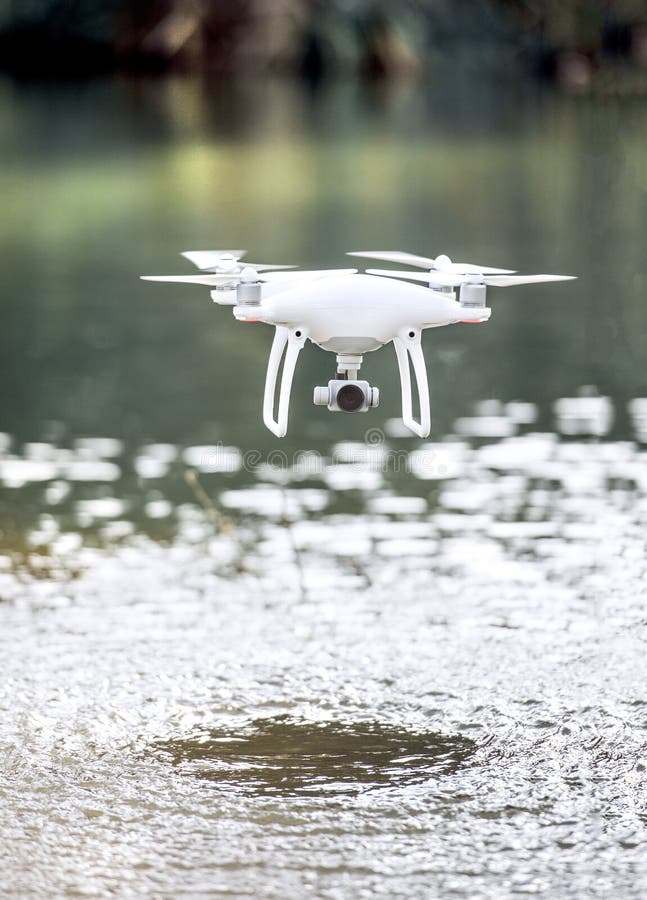
DJI Dock 3 Autonomous Hangar System: Comprehensive Analysis of 24/7 Pilotless Operations, Weatherproof Robotics, and Remote Asset Surveillance

DJI Dock 3 Autonomous Hangar System: Comprehensive Analysis of 24/7 Pilotless Operations, Weatherproof Robotics, and Remote Asset Surveillance

Pioneering a fully autonomous era in industrial facility management and perimeter security, the DJI Dock 3 system delivers a revolutionary turnkey solution for round-the-clock remote drone operations without requiring on-site human pilots. Engineered for mission-critical installations such as international borders, solar power installations, critical oil pipelines, and sprawling manufacturing plants, the Dock 3 serves as an intelligent, ruggedized robotic base station that automatically houses, cools, charges, and launches enterprise aircraft on pre-programmed or event-triggered schedules. This breakthrough technology enables centralized command centers to execute continuous aerial oversight across vast geographic expanses from a single control dashboard. From a technical and mechanical design standpoint, the Dock 3 features an ultra-durable, weather-resistant chassis built to withstand extreme environmental extremes, featuring IP55 ingress protection, internal climate control systems, and rapid-charge technology that returns an enclosed aircraft to full operational readiness in minutes. The station is specifically paired with high-performance enterprise drones equipped with advanced thermal imaging and high-resolution optical zoom sensors, allowing inspectors to detect subtle overheating electrical components or unauthorized perimeter intrusions instantly. During flight missions, the dock utilizes RTK base station positioning and intelligent alignment pins to guide the aircraft back onto its landing pad safely, even amidst severe wind gusts or blinding dust storms. The commercial marketplace supporting autonomous security and industrial monitoring infrastructure is expanding rapidly, as enterprise organizations prioritize automated risk mitigation and reduced labor overhead. Corporate tech buyers view pilotless docking stations as essential investments that transform reactive maintenance schedules into proactive predictive health programs for industrial assets. Financial analysts anticipate sustained long-term revenue growth driven by cloud software subscriptions and automated AI data analytics pipelines. in parallel with continuous cloud platform enhancements, software engineering teams maintain secure, end-to-end encrypted data transmission channels to prevent unauthorized interception of sensitive industrial surveillance streams. Developer dedication to user-friendly mission planning software ensures that security personnel can configure complex patrol perimeters with minimal training. Compliance officers verify that local aviation reporting standards and automated airspace authorization protocols are rigorously built into every deployment profile. For industrial complexes requiring uninterrupted 24/7 site monitoring, integrating the DJI Dock 3 ecosystem delivers unmatched operational readiness. Industry experts consistently recommend conducting comprehensive radio frequency surveys prior to permanent installation to guarantee seamless telemetry connectivity between the command center and the hangar unit. (Disclaimer: For reference only)
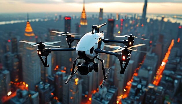
XAG P150 Max Agricultural Drone: Comprehensive Review of Multi-Functional Farm Automation, Autonomous 4D Radar, and Swarm Spreading
Global XAG P150 Max Agricultural Review

XAG P150 Max Agricultural Drone: Comprehensive Review of Multi-Functional Farm Automation, Autonomous 4D Radar, and Swarm Spreading

Pushing the boundaries of intelligent agricultural automation, the XAG P150 Max stands out as a versatile, multi-purpose heavy-duty aerial platform engineered to streamline complex farm management workflows. Designed to bridge the gap between crop protection, field seeding, and material transport, the P150 Max introduces a modular architecture that easily transitions between high-capacity liquid spraying, granular fertilizer broadcasting, and farm-site material hauling. By combining exceptional payload flexibility with advanced autonomous intelligence, the platform addresses the multifaceted demands of modern commercial farming enterprises. From a technical and mechanical design standpoint, the P150 Max features a robust, foldable carbon-fiber airframe equipped with high-efficiency quad-rotor propulsion that delivers massive downwash velocity for uniform chemical deposition. The aircraft integrates a cutting-edge 4D imaging radar system combined with binocular vision sensors, enabling fully autonomous obstacle detection and terrain-following capabilities across complex, unmapped fields without requiring pre-loaded topographical surveys. Its high-performance centrifugal spraying and spreading mechanisms allow adjustable flow rates, ensuring precise input application whether the operator is treating delicate vegetable crops or broadcasting heavy cover crop seeds across vast acreage. The commercial marketplace surrounding smart agricultural robotics is witnessing intense global competition, with farming conglomerates increasingly adopting multi-functional platforms to maximize operational efficiency and reduce equipment overhead. Market researchers highlight XAG's emphasis on modular versatility as a major commercial advantage, allowing farm operators to utilize a single hardware investment across multiple distinct seasonal agricultural tasks. in parallel with ongoing software optimization, engineering teams maintain intuitive mobile and desktop ground control applications that support multi-drone swarm coordination, enabling single operators to manage fleet-level crop treatments effortlessly. Developer commitment to durable, field-serviceable components ensures minimal maintenance downtime during punishing agricultural seasons. Compliance officers verify that environmental safety regulations and chemical application tracking standards adhere strictly to international agricultural guidelines. For agricultural producers seeking a highly adaptable, fully autonomous workhorse, deploying the XAG P150 Max offers a transformative operational upgrade. Industry experts consistently recommend utilizing the platform's multi-spectral mapping tools to generate precise variable-rate prescription files before initiating broad-acre treatment programs. (Disclaimer: For reference only)
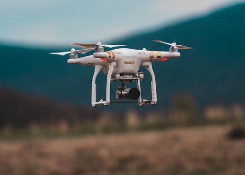
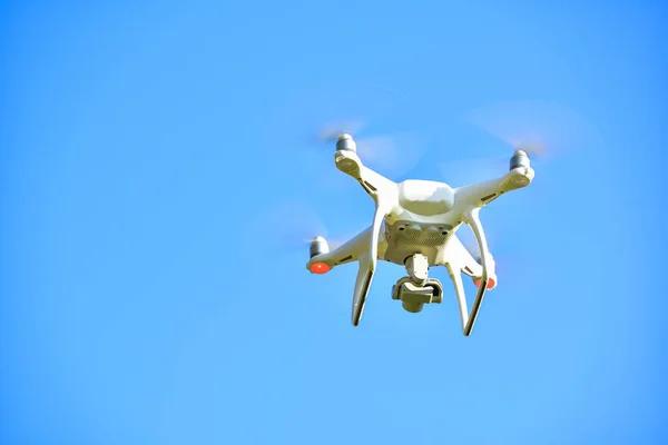
Elroy Air Chaparral Autonomous VTOL Cargo Aircraft: Comprehensive Analysis of Middle-Mile Aerial Logistics and Uncrewed Transport Innovation
Global Elroy Air Chaparral Cargo Review

Elroy Air Chaparral Autonomous VTOL Cargo Aircraft: Comprehensive Analysis of Middle-Mile Aerial Logistics and Uncrewed Transport Innovation

Redefining the future of uncrewed middle-mile logistics and regional freight distribution, the Elroy Air Chaparral represents a monumental leap forward in autonomous vertical takeoff and landing (VTOL) cargo aircraft engineering. Designed to transport substantial cargo payloads over hundreds of miles without requiring traditional airport runway infrastructure or ground handling crews at destination sites, the Chaparral serves as an efficient aerial bridge between regional distribution hubs and remote communities. The platform's historic integration into civil aviation regulatory testing programs marks a watershed moment for advanced air mobility and commercial freight logistics. From a technical and mechanical design standpoint, the Chaparral features a hybrid-electric propulsion architecture combining distributed vertical lift rotors with a high-efficiency pusher propeller for forward cruise flight. This configuration enables seamless transitions between vertical hovering and wing-borne cruising speeds, maximizing fuel efficiency over extended delivery corridors. The aircraft utilizes a specialized automated cargo pod system: pre-loaded pods are automatically loaded onto the aircraft via an integrated winch and track mechanism, allowing rapid turnaround times on the ground. Advanced onboard sensor suites, redundant flight control computers, and satellite communication links ensure fully autonomous navigation through complex airspace and unpredictable weather conditions. The commercial marketplace supporting uncrewed cargo transport is experiencing surging investor interest and active regulatory engagement, as logistics providers seek faster, cost-effective alternatives to congested highway freight networks. Industry financial analysts evaluate middle-mile VTOL cargo aircraft as a revolutionary asset class capable of transforming supply chain economics for retail distribution, humanitarian relief, and remote industrial provisioning. in parallel with rigorous flight testing protocols, aerospace engineering teams maintain secure cloud dispatch networks that monitor aircraft health, flight trajectories, and weather routing in real time. Developer dedication to fault-tolerant software architecture ensures maximum safety during autonomous takeoff and landing phases. Compliance officers verify that all experimental airworthiness certifications and operational guidelines comply strictly with national and international aviation authorities. For logistics enterprises seeking to pioneer regional autonomous freight services, integrating the Elroy Air Chaparral provides an unmatched strategic advantage. Industry experts consistently recommend establishing secure regional cargo staging pads equipped with automated charging and pod-handling infrastructure to maximize fleet throughput. (Disclaimer: For reference only)

FlyingBasket FB3 Industrial Heavy-Lift Drone: Comprehensive Review of European Aerial Construction Support and High-Capacity Payload Transport
Global FlyingBasket FB3 Heavy-Lift Review

FlyingBasket FB3 Industrial Heavy-Lift Drone: Comprehensive Review of European Aerial Construction Support and High-Capacity Payload Transport

Establishing a new benchmark for European industrial heavy-lift operations, the FlyingBasket FB3 emerges as a specialized multi-rotor platform engineered specifically for demanding construction logistics, forestry management, and heavy infrastructure maintenance. Built to tackle punishing industrial environments where cranes are impractical and ground transport is impossible, the FB3 excels at hoisting substantial weights across complex alpine valleys and dense urban construction sites, setting a high standard for commercial utility aviation. From a technical and mechanical design standpoint, the FB3 utilizes an eight-rotor coaxial airframe architecture designed around a robust 100-kilogram payload capacity. The platform features quick-swappable battery packs and an industrial cargo hook system that allows rapid attachment and release of heavy construction materials, timber bundles, and telecommunication equipment. The onboard flight control system incorporates high-precision RTK GPS positioning and advanced wind-compensation algorithms, ensuring pinpoint hovering stability and cargo placement accuracy even when operating in severe crosswinds or turbulent mountain microclimates. The commercial marketplace surrounding industrial heavy-lift drone services is experiencing steady, high-value adoption among European construction firms and utility providers seeking safer, faster alternatives to traditional helicopter charters. Industry financial analysts evaluate heavy-lift multirotors as cost-effective capital investments that significantly reduce project delivery times while eliminating the high operational overhead associated with crewed aviation. in parallel with ongoing software enhancement, engineering teams maintain rigorous diagnostic frameworks to monitor motor performance, electrical load distribution, and structural integrity parameters continuously. Developer dedication to operator safety ensures comprehensive fail-safe redundancies, including automatic emergency landing profiles and dual-parachute deployment systems. Compliance officers verify that all industrial aviation compliance certifications and safety standards adhere strictly to European Union aviation regulations. For construction and utility enterprises requiring heavy-payload lifting capability in inaccessible locations, deploying the FlyingBasket FB3 delivers an indispensable operational tool. Industry experts consistently recommend conducting thorough load-rigging checks and wind-shear assessments prior to executing high-altitude lifting missions. (Disclaimer: For reference only)

Skydio X10D Defense and Public Safety Drone: Comprehensive Analysis of Autonomous Tactical Reconnaissance and NDAA-Compliant Military Operations
Global Skydio X10D Defense Review

Skydio X10D Defense and Public Safety Drone: Comprehensive Analysis of Autonomous Tactical Reconnaissance and NDAA-Compliant Military Operations

Setting the gold standard for tactical military reconnaissance and domestic public safety operations, the Skydio X10D delivers an advanced, NDAA-compliant autonomous drone platform engineered for elite defense units and emergency first responders. Designed to operate in hostile, GPS-denied, and highly contested electromagnetic environments, the X10D removes the cognitive burdens of manual flight control, empowering operators to focus entirely on critical mission objectives while the aircraft independently maps, navigates, and analyzes complex tactical situations in real time. From a technical and mechanical design standpoint, the platform features a rugged, rapidly deployable airframe outfitted with an unmatched 360-degree computer vision sensor array powered by high-performance NVIDIA edge-computing hardware. This enables real-time 3D environment modeling and advanced autonomous obstacle avoidance that tracks moving subjects through pitch-black subterranean complexes, ruined urban environments, and dense forest canopies without satellite navigation signals. The modular payload bay supports hot-swappable thermal imaging cameras, high-definition zoom optics, and encrypted military data links, ensuring secure video transmission and uncompromised situational awareness for command staff. The commercial and defense marketplace supporting secure tactical drone technology is experiencing unprecedented procurement expansion, driven by rigorous government security requirements and the proven combat effectiveness of autonomous aerial assets. Defense analysts evaluate Skydio's software-driven approach as a vital competitive advantage, ensuring that existing hardware fleets remain continuously upgradeable with new tactical capabilities via over-the-air software deployments. in parallel with rigorous military-standard testing, engineering teams maintain stringent cybersecurity protocols to prevent unauthorized interception or tampering of operational telemetry. Developer dedication to intuitive user interfaces ensures that field operators can master rapid deployment within minutes of training. Compliance officers verify that strict export control regulations and federal defense contracting guidelines are met without exception. For defense and public safety agencies seeking uncompromised situational intelligence, integrating the Skydio X10D into tactical workflows provides a decisive operational edge. Industry experts consistently recommend utilizing autonomous perimeter-orbit flight modes during nighttime tactical clearings to maximize thermal signature detection sensitivity. (Disclaimer: For reference only)

ACSL SOTEN Industrial Inspection Drone: Comprehensive Review of Secure Japanese Engineering, High-Precision Visuals, and Federal Compliance Standards
Global ACSL SOTEN Industrial Review

ACSL SOTEN Industrial Inspection Drone: Comprehensive Review of Secure Japanese Engineering, High-Precision Visuals, and Federal Compliance Standards

Representing a triumph in secure, high-precision industrial engineering, the ACSL SOTEN drone emerges as a premier professional inspection platform engineered to satisfy the strictest data security and regulatory compliance frameworks. Developed in Japan, the SOTEN is specifically tailored for critical infrastructure assessment, bridge inspection, and utility monitoring where data privacy, cyber resilience, and manufacturing origin transparency are paramount priorities for enterprise and government procurement boards. From a technical and mechanical design standpoint, the platform features an innovative, highly secure flight control architecture paired with an easily swappable camera system that supports dual optical and thermal imaging payloads. A standout feature of the SOTEN is its encrypted data communication protocol and secure physical storage mechanism, which prevents unauthorized data extraction and safeguards sensitive industrial inspection footage against cyber espionage. The airframe is lightweight yet durable, offering exceptional wind resistance and stable flight performance around complex steel structures, high-voltage transmission towers, and narrow industrial corridors. The commercial marketplace surrounding secure industrial inspection drones is experiencing robust growth, as corporations and government agencies diversify their fleets to include trusted non-restricted manufacturing options that comply with stringent federal security mandates. Financial analysts evaluate secure regional drone manufacturers as vital market components that protect critical supply chains from sudden regulatory disruptions and data privacy vulnerabilities. in parallel with ongoing software enhancements, engineering teams maintain dedicated encryption update pipelines to protect against evolving cyber threats. Developer responsiveness to enterprise feedback ensures regular improvements to automated flight planning interfaces and detailed inspection reporting tools. Compliance officers verify that all regional data protection laws and federal procurement guidelines are strictly integrated into every operational profile. For industrial enterprises prioritizing uncompromising data security alongside high-performance inspection capabilities, deploying the ACSL SOTEN provides an ideal strategic solution. Industry experts consistently recommend utilizing the swappable camera modules to adapt the airframe quickly between routine visual documentation and thermal electrical audits. (Disclaimer: For reference only)

DJI Matrice 400 Survey and Inspection Drone: Comprehensive Analysis of Enterprise Photogrammetry, LiDAR Integration, and Long-Endurance Flight
Global DJI Matrice 400 Survey Review

DJI Matrice 400 Survey and Inspection Drone: Comprehensive Analysis of Enterprise Photogrammetry, LiDAR Integration, and Long-Endurance Flight

Reinventing the pinnacle of commercial survey and heavy-payload industrial inspection, the DJI Matrice 400 arrives as a powerhouse enterprise drone designed to supersede legacy multirotor platforms with vastly superior endurance, sensor payload capacity, and intelligent automation. Engineered for large-scale topographical mapping, linear corridor surveys, and complex structural audits, the Matrice 400 provides professional engineering and surveying firms with an uncompromised tool capable of handling the most rigorous field assignments with absolute precision. From a technical and mechanical design standpoint, the Matrice 400 features a weather-resistant IP55 airframe housing advanced redundant flight control systems and high-capacity dual batteries that deliver exceptional flight endurance up to 55 minutes while carrying heavy sensor payloads. The platform supports DJI's cutting-edge enterprise payload ecosystem, including the Zenmuse L3 LiDAR system for centimeter-accurate vegetation-penetrating point clouds and the Zenmuse P1 full-frame camera for expansive photogrammetry. Omnidirectional obstacle sensing driven by advanced AI algorithms ensures safe navigation close to complex industrial structures, transmission lines, and rugged terrain features. The commercial marketplace supporting professional surveying and infrastructure inspection is adopting the Matrice 400 as the definitive industry workhorse, driving high attach rates across civil engineering, mining, and GIS mapping sectors. Financial analysts note that the platform's extended flight endurance and rapid data processing integration significantly reduce field hours, translating to immediate labor cost savings for commercial contractors. in parallel with ongoing software optimization, engineering teams maintain native integration with DJI Terra software for real-time 2D/3D model reconstruction and point cloud processing directly in the field. Developer commitment to enterprise safety includes robust return-to-home logic and multi-tier failsafe redundancies. Compliance officers verify that aviation safety standards and remote ID broadcasting regulations comply strictly with international laws. For surveying and inspection enterprises seeking maximum productivity and data accuracy, deploying the DJI Matrice 400 delivers an unbeatable competitive edge. Industry experts consistently recommend pairing the aircraft with the Zenmuse L3 LiDAR payload to achieve maximum survey efficiency across densely vegetated terrain corridors. (Disclaimer: For reference only)

Freefly Alta X Cinema Drone: Comprehensive Review of Heavy-Payload Film Production, Professional Camera Integration, and Dynamic Aerial Cinematography
Global Freefly Alta X Cinema Review

Freefly Alta X Cinema Drone: Comprehensive Review of Heavy-Payload Film Production, Professional Camera Integration, and Dynamic Aerial Cinematography

Setting the definitive industry benchmark for high-end cinematic aerial production, the Freefly Alta X remains the premier heavy-payload multirotor platform trusted by professional filmmakers and high-end commercial production houses worldwide. Designed from the ground up to accommodate professional cinema camera packages that traditional drones cannot lift, the Alta X empowers cinematographers to capture breathtaking, stable, large-format aerial footage without compromising on glass quality, camera body features, or creative framing control. From a technical and mechanical design standpoint, the Alta X features a sophisticated carbon-fiber frame capable of supporting top- or bottom-mounted camera payloads weighing up to 16 kilograms, including professional cinema setups from ARRI, RED, and large-format digital cinema brands. The aircraft's proprietary active dampening system isolates the camera gimbal from high-frequency motor vibrations, ensuring buttery-smooth footage even during high-speed aggressive maneuvers reaching up to 97 kilometers per hour. Its rapid-folding carbon-fiber structural design allows the entire heavy-lift rig to pack down efficiently into standard transport cases for global travel. The commercial marketplace supporting prestige film production and high-budget commercial advertising continues to demand uncompromised camera performance, cementing the Alta X as an essential asset on elite production sets. Industry analysts evaluate high-end cinema drones as crucial creative tools that elevate visual storytelling standards across feature films, television series, and premium brand campaigns. in parallel with ongoing firmware refinement, engineering teams maintain rigorous quality control standards to ensure flawless synchronization between flight stability systems and external gimbal controllers. Developer commitment to open architecture standards allows DPs and camera operators to integrate custom power distribution and wireless video transmission rigs effortlessly. Compliance officers verify that commercial aviation safety guidelines and local film permit regulations are strictly observed during complex on-set operations. For production teams seeking ultimate cinematic freedom and heavy-lift reliability, deploying the Freefly Alta X provides an unmatched artistic triumph. Industry experts consistently recommend performing comprehensive balance calibrations on the gimbal setup prior to flight to maximize battery endurance and flight stability during dynamic tracking shots. (Disclaimer: For reference only)

DJI Mavic 4 Pro Flagship Aerial Platform: Comprehensive Analysis of Triple-Camera Architecture, 6K Video Capabilities, and Extended Flight Autonomy
Global DJI Mavic 4 Pro Flagship Review

DJI Mavic 4 Pro Flagship Aerial Platform: Comprehensive Analysis of Triple-Camera Architecture, 6K Video Capabilities, and Extended Flight Autonomy

Representing a monumental technological milestone in consumer and professional aerial cinematography, the DJI Mavic 4 Pro arrives as the definitive flagship showcase of modern drone engineering. Designed to satisfy the exacting demands of professional filmmakers, commercial content creators, and advanced aerial photographers, the Mavic 4 Pro integrates a revolutionary triple-camera optical system with unprecedented flight endurance. This platform bridges the traditional performance gap between bulky heavy-lift cinema rigs and portable folding drones, establishing a new global standard for visual fidelity and operational flexibility in aerial media production. From a technical and mechanical design standpoint, the aircraft features a sophisticated aerodynamic airframe housing a powerful triple-sensor array: a primary 4/3-inch large-format sensor capable of capturing stunning 100-megapixel photos and 6K video at 60 frames per second, complemented by a 70mm medium telephoto lens and a 168mm telephoto lens optimized for compression shots. Power architecture advancements deliver an exceptional battery endurance of up to 51 minutes of continuous flight, while an enhanced omnidirectional obstacle detection system reinforced by integrated LiDAR sensors ensures absolute navigational safety. The O4 enterprise-grade transmission system guarantees ultra-stable, high-definition live video feeds over extended operational distances even in congested signal environments. The commercial marketplace surrounding high-end media creation and aerial inspection has embraced the Mavic 4 Pro with overwhelming enthusiasm, driving massive global adoption across advertising agencies, real estate media firms, and environmental documentation projects. Industry financial analysts highlight the drone's versatile multi-sensor payload configuration as a major economic asset, allowing solo operators to execute complex cinematic sequences that previously required multi-crew production teams and expensive dedicated cinema aircraft. in parallel with continuous hardware refinement, software engineering teams maintain robust firmware update channels that enhance intelligent tracking modes, waypoint route planning, and automated cinematic maneuvers. Developer dedication to user interface optimization ensures that pilots can execute repeatable, automated flight paths with centimeter-level precision. Compliance officers verify that remote ID broadcasting features and local aviation safety parameters comply strictly with international regulatory standards. For professional creators and commercial operators seeking absolute optical excellence and extended flight reach, deploying the DJI Mavic 4 Pro delivers an unbeatable creative advantage. Industry experts consistently recommend utilizing the primary 4/3-inch sensor with D-Log M color profiles to maximize dynamic range flexibility during post-production color grading workflows. (Disclaimer: For reference only)

DJI Mini 5 Pro Ultra-Lightweight Aerial Drone: Comprehensive Review of 1-Inch Sensor Performance, Obstacle Avoidance, and Sub-250g Regulatory Freedom
Global DJI Mini 5 Pro Review

DJI Mini 5 Pro Ultra-Lightweight Aerial Drone: Comprehensive Review of 1-Inch Sensor Performance, Obstacle Avoidance, and Sub-250g Regulatory Freedom

Shattering conventional performance limits for ultra-lightweight aerial platforms, the DJI Mini 5 Pro redefines what is technologically possible within a sub-250-gram airframe. Engineered specifically for mobile content creators, travel journalists, and urban explorers who require professional-grade imaging quality without the heavy administrative burden of commercial drone licensing, the Mini 5 Pro packs high-end cinematic features and advanced safety infrastructure into a pocket-sized, folding form factor that complies with relaxed aviation frameworks worldwide. From a technical and mechanical design standpoint, the aircraft incorporates a remarkable 1-inch CMOS sensor capable of capturing crisp 50-megapixel still images and 4K video at an ultra-smooth 120 frames per second. Crucially, unlike previous lightweight iterations, the Mini 5 Pro integrates a full omnidirectional obstacle detection system and advanced LiDAR-assisted landing sensors, ensuring robust safety during complex close-proximity flights. The redesigned gimbal supports true vertical shooting configurations for social media content creation, while intelligent tracking algorithms like ActiveTrack 360° maintain locked-on subject framing during dynamic movement routines across challenging outdoor environments. The commercial marketplace for compact, high-performance consumer drones continues to expand aggressively, with travel vloggers, real estate agents, and independent videographers favoring equipment that minimizes travel friction without sacrificing image fidelity. Market analysts note that sub-250-gram flagships consistently capture the largest volume share of consumer retail purchases due to their universal appeal and favorable legal operating status across international borders. in parallel with ongoing mobile app optimization, software engineering teams maintain intuitive flight control interfaces that simplify complex cinematic shots for novice and professional pilots alike. Developer commitment to battery cell efficiency ensures maximized flight times despite the inclusion of heavy-duty cooling systems and high-output image processors. Compliance officers verify that regional lightweight drone exemption rules and privacy protection guidelines are rigorously supported by the onboard software architecture. For creators seeking uncompromising video resolution in a travel-friendly package, the DJI Mini 5 Pro provides an exceptional operational solution. Industry experts consistently recommend utilizing built-in ND filter sets during bright daylight shoots to maintain optimal shutter speed ratios for cinematic motion blur. (Disclaimer: For reference only)

DJI Air 3S Versatile Dual-Camera Drone: Comprehensive Analysis of Wide-Angle Performance, Night-Vision Sensing, and Long-Range Transmission
Global DJI Air 3S Versatile Drone Review

DJI Air 3S Versatile Dual-Camera Drone: Comprehensive Analysis of Wide-Angle Performance, Night-Vision Sensing, and Long-Range Transmission

Positioned as the ultimate mid-range powerhouse for versatile aerial documentation, the DJI Air 3S delivers an exceptional balance of professional dual-camera imaging, advanced safety sensors, and robust wind resistance. Engineered for landscape photographers, emergency responders, and corporate media teams who require a reliable everyday workhorse that sits comfortably between ultra-portable hobby drones and heavy enterprise systems, the Air 3S excels across diverse operational scenarios ranging from coastal mapping to nighttime search operations. From a technical and mechanical design standpoint, the aircraft features a dual-primary camera system housing a 1-inch 50-megapixel wide-angle sensor and a secondary 1/1.3-inch 48-megapixel medium telephoto lens, providing seamless focal length transitions without optical degradation. A groundbreaking addition to the Air 3S architecture is its forward-facing LiDAR and advanced nighttime obstacle-sensing capability, which utilizes specialized algorithms to map unlit environments and prevent collisions during low-light missions. Powered by an advanced O4 transmission system, the drone maintains crystal-clear 1080p video feeds over transmission distances reaching up to 20 kilometers in unobstructed regulatory zones. The commercial marketplace supporting mid-tier commercial photography and municipal inspection is adopting the Air 3S rapidly, valued for its high reliability and cost-effective operational profile. Financial market analysts evaluate the Air 3S as an optimal investment for regional enterprises seeking professional-grade dual-sensor data capture capabilities without committing to expensive industrial hardware budgets. in parallel with continuous firmware optimization, engineering teams maintain secure cloud synchronization tools that allow operators to back up flight logs and media files instantly upon landing. Developer dedication to autonomous flight safety features includes redundant compass calibration routines and intelligent return-to-home path optimization. Compliance officers verify that aviation safety standards and local broadcast compliance requirements adhere strictly to global aviation rules. For operators seeking high versatility and dependable multi-environment performance, deploying the Air 3S delivers an outstanding return on investment. Industry experts consistently recommend utilizing the medium telephoto lens for architectural inspections to maintain safe standoff distances while capturing intricate structural details. (Disclaimer: For reference only)

DJI Avata 2 Immersive FPV Drone: Comprehensive Review of First-Person View Flight, 4K Stabilization, and Safe Acrobatic Maneuvering
Global DJI Avata 2 Immersive FPV Review

DJI Avata 2 Immersive FPV Drone: Comprehensive Review of First-Person View Flight, 4K Stabilization, and Safe Acrobatic Maneuvering

Revolutionizing the realm of immersive first-person view (FPV) flight and dynamic action videography, the DJI Avata 2 stands out as an exceptionally refined agile drone designed to make high-speed cinematic aerobatics accessible to both seasoned pilots and enthusiastic beginners. Built to capture heart-pounding, low-altitude sweeping shots through tight gaps, forest clearings, and industrial ruins, the Avata 2 merges the raw excitement of traditional manual FPV racing with the unmatched safety and stability of modern consumer flight control technology. From a technical and mechanical design standpoint, the aircraft features an integrated aerodynamic duct-fan protective frame that safeguards the propellers against impacts, allowing the drone to bounce off obstacles and automatically recover upright if it comes to rest upside down on the ground. The imaging system centers around a 1/1.3-inch CMOS sensor capable of recording crisp 4K video at 100 frames per second paired with ultra-wide 155-degree field-of-view optics. Coupled with DJI's RockSteady and HorizonSteady digital stabilization algorithms, the footage remains remarkably fluid even during aggressive banking turns and high-velocity dives. The intuitive motion controller accessory allows pilots to steer simply by pointing their hand, transforming complex flight maneuvers into a natural, intuitive experience. The commercial marketplace for dynamic sports broadcasting, action filmmaking, and creative commercial advertising has embraced the Avata 2 as an indispensable tool for capturing visceral, high-energy perspectives that traditional camera drones cannot replicate. Industry analysts note that intuitive motion control interfaces have dramatically lowered the entry barrier for immersive flight, expanding the addressable market across creative industries. in parallel with ongoing goggles firmware updates, software development teams maintain robust transmission security protocols that minimize latency and prevent signal dropouts during complex indoor flights. Developer commitment to user safety features includes an emergency brake button on the controller that instantly halts the aircraft and initiates a secure hover. Compliance officers verify that FPV observer requirements and local airspace regulations are fully supported through software reminder prompts. For content creators seeking exhilarating, cinematic first-person footage with built-in safety assurances, deploying the DJI Avata 2 provides an unmatched creative outlet. Industry experts consistently recommend practicing maneuvers in simulator environments before executing high-speed proximity flights around complex physical structures. (Disclaimer: For reference only)

DJI Neo 2 Autonomous Selfie Drone: Comprehensive Analysis of Pocket-Sized Palm Launch, AI Tracking, and Vlogging Innovation
Global DJI Neo 2 Autonomous Selfie Review

DJI Neo 2 Autonomous Selfie Drone: Comprehensive Analysis of Pocket-Sized Palm Launch, AI Tracking, and Vlogging Innovation

Transforming the concept of personal aerial photography and social media content creation, the DJI Neo 2 emerges as an ultra-compact, featherlight autonomous selfie drone designed for effortless palm-of-the-hand launch and landing. Engineered for everyday vloggers, outdoor adventurers, and casual travelers who want hands-free cinematic documentation of their experiences without wrestling with complex controller setups, the Neo 2 acts as a personal flying camera crew that follows users automatically through intelligent AI tracking algorithms. From a technical and mechanical design standpoint, the airframe weighs a mere 151 grams (without transceiver) and features fully enclosed propeller guards that ensure complete safety for close-proximity hand launches and indoor environments. The onboard camera utilizes a high-clarity 1/2-inch sensor capable of shooting sharp 4K video at 100 frames per second, supported by advanced electronic image stabilization to iron out walking and running vibrations. Users can initiate pre-programmed flight choreography paths—such as Dronie, Circle, Rocket, and Spotlight—directly via quick-selection buttons on the aircraft body or through voice control commands, eliminating the mandatory requirement for a smartphone or dedicated remote controller during casual outings. The commercial marketplace surrounding creator economy tools and lifestyle gadgets has welcomed the Neo series as a revolutionary category creator, driving massive consumer adoption among younger demographics and travel enthusiasts. Financial analysts highlight the ultra-portable pocket format as a key driver of retail growth, effectively bridging the gap between action cameras and traditional flying drones. in parallel with continuous mobile application enhancements, engineering teams maintain responsive firmware pipelines that optimize AI subject recognition and tracking responsiveness across dynamic lighting conditions. Developer dedication to user-friendly design ensures that even individuals with zero aviation experience can operate the device safely within seconds. Compliance officers verify that local lightweight unmanned aircraft regulations are respected through built-in altitude and distance boundaries. For lifestyle content creators seeking a frictionless, automated documentation tool, integrating the DJI Neo 2 into daily travel routines delivers exceptional convenience. Industry experts consistently recommend utilizing voice control activation in windy outdoor settings to keep hands free and maintain stable body posture during launch sequences. (Disclaimer: For reference only)

DJI Matrice 30T Enterprise Thermal Drone: Comprehensive Review of Industrial Inspection, All-Weather Resilience, and Public Safety Operations
Global DJI Matrice 30T Enterprise Review

DJI Matrice 30T Enterprise Thermal Drone: Comprehensive Review of Industrial Inspection, All-Weather Resilience, and Public Safety Operations

Establishing an industry standard for professional public safety response and critical industrial asset inspection, the DJI Matrice 30T delivers a powerful, ruggedized enterprise drone platform engineered to operate reliably in the most punishing weather and environmental extremes. Designed for police tactical units, firefighters, search and rescue squads, and energy grid inspectors, the Matrice 30T combines a compact, foldable airframe with an advanced multi-sensor payload array that provides uncompromised thermal and optical situational awareness around the clock. From a technical and mechanical design standpoint, the aircraft features an IP55 weather-resistant chassis capable of withstanding heavy rain, gale-force winds, sub-zero temperatures, and corrosive industrial atmospheres. Its integrated payload system houses a 640x512 thermal imaging camera, a 48-megapixel high-resolution wide-angle optical sensor, a 16x optical zoom camera, and a laser rangefinder capable of pinpointing precise geographical coordinates of objects up to a kilometer away. Dual battery redundancy and self-heating battery cells ensure rapid deployment readiness, while seamless compatibility with the automated DJI Dock ecosystem allows remote deployment from permanent unattended hangars. The commercial marketplace supporting emergency services and utility maintenance has widely standardized on the Matrice 30T due to its exceptional reliability and comprehensive multi-sensor utility. Enterprise market analysts evaluate the platform as a mission-critical investment that drastically reduces emergency response assessment times and prevents catastrophic industrial failures through proactive thermal anomaly detection. in parallel with ongoing software integration, backend engineering teams maintain secure connection pipelines with DJI FlightHub 2, enabling real-time video streaming to remote command centers during active incidents. Developer commitment to flight safety includes redundant IMUs, dual barometers, and automatic parachute deployment integration options. Compliance officers verify that aviation safety standards and enterprise data security protocols comply strictly with government procurement mandates. For public safety agencies and industrial operators requiring uncompromised all-weather performance, deploying the DJI Matrice 30T provides an essential operational capability. Industry experts consistently recommend performing regular thermal calibration checks to ensure absolute temperature measurement accuracy during electrical substation audits. (Disclaimer: For reference only)

DJI Agras T50 Precision Agricultural Sprayer: Comprehensive Analysis of High-Capacity Crop Protection, Orchard Mapping, and Sustainable Farming
Global DJI Agras T50 Agricultural Review

DJI Agras T50 Precision Agricultural Sprayer: Comprehensive Analysis of High-Capacity Crop Protection, Orchard Mapping, and Sustainable Farming

Driving the global digital transformation of mid-to-large-scale agricultural management, the DJI Agras T50 stands out as a highly optimized heavy-payload spraying and spreading drone engineered to maximize crop yields while minimizing chemical expenditure. Designed for farming cooperatives, commercial agricultural contractors, and orchard managers, the T50 combines an efficient dual-atomizing spraying system with advanced multi-spectral terrain-following radar, delivering precise, data-driven crop protection across complex agricultural landscapes. From a technical and mechanical design standpoint, the T50 features a robust folding coaxial rotor airframe equipped with a 50-liter liquid spraying tank or a 75-liter spreading hopper, achieving remarkable operational coverage rates exceeding 22 acres per hour. The dual atomization spraying mechanism ensures uniform droplet distribution, eliminating chemical drift and enhancing leaf underside coverage. Equipped with active phased array radars and binocular vision sensors, the aircraft detects power lines, branches, and topographical contours autonomously, allowing safe low-altitude flight over sloping orchards and irregular field boundaries. The high-output generator charging system supports continuous round-the-clock field operations during intense seasonal crop treatment windows. The commercial marketplace supporting smart agriculture is experiencing rapid adoption of heavy-duty agricultural drones, driven by acute rural labor shortages and strict environmental regulations governing chemical runoff. Financial analysts highlight the T50's exceptional return on investment, noting that targeted variable-rate spraying significantly reduces expensive fertilizer and pesticide input costs for commercial growers. in parallel with continuous software enhancements, engineering teams maintain intuitive offline mission planning tools that enable farmers to generate precise variable-rate prescription maps without requiring active internet connections. Developer dedication to field durability is reflected in the aircraft's IP67 water resistance rating, allowing complete high-pressure water washing after corrosive chemical applications. Compliance officers verify that environmental safety guidelines and pesticide application tracking standards adhere strictly to international agricultural laws. For agricultural enterprises seeking maximum operational productivity, deploying the DJI Agras T50 delivers a transformative farming upgrade. Industry experts consistently recommend conducting preliminary multi-spectral drone mapping flights to establish accurate crop health baselines prior to initiating automated treatment programs. (Disclaimer: For reference only)
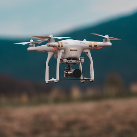
Zenmuse L3 LiDAR Professional Surveying Payload: Comprehensive Review of High-Accuracy Point Cloud Generation and Topographical Mapping
Global Zenmuse L3 LiDAR Survey Review

Zenmuse L3 LiDAR Professional Surveying Payload: Comprehensive Review of High-Accuracy Point Cloud Generation and Topographical Mapping

Setting an uncompromising standard for aerial surveying, civil engineering, and forestry mapping, the Zenmuse L3 LiDAR payload represents the pinnacle of high-precision geospatial data collection technology. Engineered for seamless integration with enterprise drone platforms like the Matrice series, the L3 combines a high-performance laser scanner, a mapping camera, and a high-accuracy inertial navigation system into a unified housing, empowering geospatial professionals to generate centimeter-accurate 3D point clouds across dense vegetation and complex topography. From a technical and mechanical design standpoint, the L3 features an advanced laser emission mechanism capable of multiple returns per pulse, allowing laser beams to penetrate canopy foliage and accurately map ground elevation models hidden beneath thick forests. The integrated RGB mapping camera captures high-resolution texture details simultaneously, enabling automated true-color point cloud colorization in post-processing software such as DJI Terra. Enhanced absolute vertical and horizontal accuracy metrics make the system ideal for corridor surveys, mining volume calculations, urban planning, and infrastructure deformation monitoring. The commercial marketplace supporting professional surveying and GIS mapping has rapidly adopted LiDAR technology as an essential asset that cuts traditional ground survey timelines down from weeks to mere hours. Financial market analysts project strong, sustained revenue growth for aerial geospatial hardware providers as infrastructure projects worldwide demand high-definition digital twin models. in parallel with ongoing software optimization, engineering teams maintain streamlined data processing pipelines that minimize point cloud rendering latency and export clean, compatible data formats for standard CAD and GIS software suites. Developer commitment to hardware reliability ensures stable performance during extended linear corridor flight missions. Compliance officers verify that airspace authorization protocols and geodetic surveying standards comply strictly with regional mapping laws. For surveying enterprises seeking absolute measurement precision and efficient terrain penetration, integrating the Zenmuse L3 payload delivers an indispensable competitive advantage. Industry experts consistently recommend establishing ground control points prior to flight to verify absolute coordinate accuracy across large-scale mapping projects. (Disclaimer: For reference only)
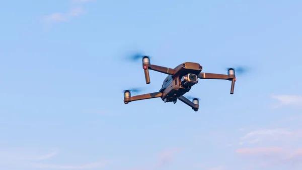
DJI FlyCart 30 Heavy-Duty Utility Cargo Drone: Comprehensive Analysis of Mountain Freight Transport and Infrastructure Supply Chains
Global DJI FlyCart 30 Cargo Review

DJI FlyCart 30 Heavy-Duty Utility Cargo Drone: Comprehensive Analysis of Mountain Freight Transport and Infrastructure Supply Chains

Redefining the logistical possibilities of heavy cargo transport across challenging terrains, the DJI FlyCart 30 stands as a premier utility freight drone engineered to solve complex supply chain challenges in mountainous regions, offshore installations, and disaster relief zones. By replacing hazardous, time-consuming ground transport and expensive crewed helicopter charters with direct, point-to-point aerial cargo delivery, the FlyCart 30 safeguards supply lines and revolutionizes material logistics for construction and utility enterprises. From a technical and mechanical design standpoint, the aircraft features a high-strength four-axis, eight-propeller coaxial carbon-fiber airframe designed for exceptional wind resistance under maximum payloads. It offers a dual-mode cargo configuration: a spacious 70-liter cargo container equipped with automatic center-of-gravity balancing sensors, and an industrial winch system featuring a 20-meter steel cable for precise cargo lowering in environments lacking flat landing zones. Powered by dual high-capacity batteries with intelligent self-heating capabilities, the aircraft maintains stable flight performance while hauling up to 30 kilograms of cargo. Advanced dual-radar obstacle sensing and an integrated emergency parachute system ensure maximum flight safety across unpredictable operational routes. The commercial marketplace surrounding industrial aerial freight and remote infrastructure maintenance is experiencing explosive growth, as utility companies and construction contractors aggressively integrate heavy-duty cargo drones into their daily asset management workflows. Financial analysts evaluate automated aerial logistics as a major cost-cutting innovation that accelerates project completion schedules and eliminates human risk in treacherous terrain. in parallel with continuous software refinement, backend engineering teams maintain encrypted fleet management networks that allow remote supervisors to monitor cargo routes, battery health, and winch operations in real time. Developer responsiveness to industrial user feedback ensures regular optimization for automated emergency fail-safes and return-to-home pathways. Compliance officers verify that civil aviation authority regulations regarding heavy-payload commercial transport adhere strictly to international airspace laws. For industrial enterprises managing remote supply chains, investing in the DJI FlyCart 30 offers a highly reliable transport solution. Industry experts consistently recommend mapping precise GPS landing corridors and pre-clearing winch drop zones to ensure maximum operational safety during high-frequency material delivery cycles. (Disclaimer: For reference only)
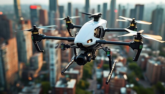
Anduril Thunder Autonomous Attack Rotorcraft: Comprehensive Review of Next-Generation Military Uncrewed Systems and Software-Defined Defense
Global Anduril Thunder Defense Review

Anduril Thunder Autonomous Attack Rotorcraft: Comprehensive Review of Next-Generation Military Uncrewed Systems and Software-Defined Defense

Pioneering the future of software-defined military aviation and autonomous defense architecture, the Anduril Thunder emerges as a revolutionary Group 5 autonomous attack rotorcraft designed to operate seamlessly alongside crewed military helicopters or as part of larger uncrewed formations. Engineered to address modern contested battlefield demands, the Thunder integrates advanced distributed AI coordination, modular payload flexibility, and high-speed cruise performance to execute complex tactical missions in environments previously considered too hazardous for human aviators. From a technical and mechanical design standpoint, the aircraft features a high-performance rotorcraft airframe engineered around an open-systems software architecture powered by Anduril's Lattice operating system. This enables decentralized swarm intelligence, autonomous threat identification, and real-time path planning without relying on constant satellite communication links or manual ground piloting. The modular internal and external payload bays support a vast array of mission configurations, ranging from electronic warfare jamming suites and reconnaissance sensors to precision-guided munitions, allowing field commanders to adapt the aircraft rapidly to shifting combat requirements. The global defense marketplace supporting uncrewed combat systems is experiencing an unprecedented paradigm shift toward autonomous, software-defined hardware platforms that offer rapid upgradeability and lower lifecycle costs compared to traditional crewed military aircraft. Defense market analysts evaluate Anduril's approach as a vital strategic disruption that ensures military forces maintain technological superiority against evolving electronic warfare and air defense threats. in parallel with rigorous military flight testing protocols, software engineering teams maintain stringent cybersecurity protocols to protect operational telemetry against sophisticated cyber attacks and signal jamming. Developer dedication to open architecture standards allows third-party defense contractors to integrate new sensor algorithms seamlessly. Compliance officers verify that all export control laws and international defense contracting guidelines are met without exception. For defense agencies seeking uncompromised tactical autonomy and flexible combat capabilities, integrating the Anduril Thunder into operational doctrines delivers a decisive strategic edge. Industry experts consistently recommend conducting comprehensive electronic warfare simulation tests before deploying autonomous rotorcraft into heavily defended airspace corridors. (Disclaimer: For reference only)
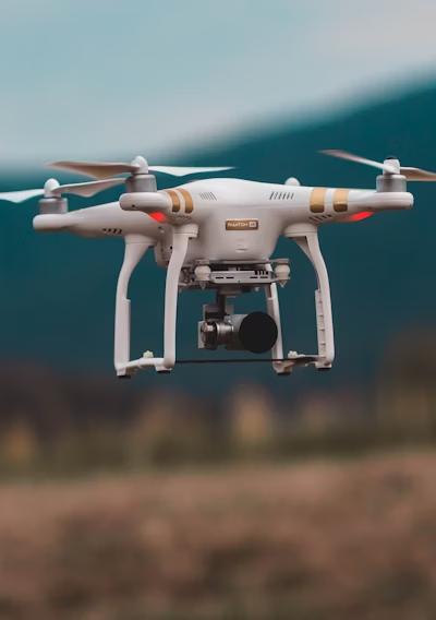
DJI Matrice 350 RTK Industrial Flagship Drone: Comprehensive Analysis of Enhanced Flight Safety, O3 Enterprise Transmission, and Versatile Payload Integration
Global DJI Matrice 350 RTK Industrial Review

DJI Matrice 350 RTK Industrial Flagship Drone: Comprehensive Analysis of Enhanced Flight Safety, O3 Enterprise Transmission, and Versatile Payload Integration

Representing the absolute gold standard in industrial multi-rotor aviation, the DJI Matrice 350 RTK emerges as a heavy-duty, highly versatile enterprise platform engineered to serve as the definitive backbone for professional surveying, infrastructure inspection, and public safety operations. Designed to operate under punishing environmental conditions and rigorous daily workloads, the Matrice 350 RTK introduces upgraded propulsion systems, advanced flight control redundancies, and an improved battery management ecosystem that delivers extended mission endurance while carrying demanding sensor payloads. From a technical and mechanical design standpoint, the aircraft features an IP55 weather-resistant airframe capable of withstanding heavy dust, rain, and extreme temperature fluctuations from sub-zero winters to scorching summer heat. Its advanced flight control architecture integrates dual-redundant IMUs, barometers, and compasses, supported by a six-directional binocular vision and infrared sensing system that provides robust omnidirectional obstacle avoidance. The platform utilizes the enterprise-grade O3 Enterprise Transmission protocol, ensuring stable, encrypted triple-channel 1080p live video feeds over transmission distances up to 20 kilometers. Power is supplied by a dual-battery TB65 system featuring hot-swapping capabilities, allowing flight crews to replace depleted batteries without shutting down the aircraft avionics, thereby eliminating mission startup delays. The commercial marketplace supporting enterprise surveying, power grid inspection, and search-and-rescue operations has widely standardized on the Matrice series as the primary mission-critical hardware investment. Industry financial analysts highlight the platform's exceptional payload versatility—supporting multi-sensor optical cameras, LiDAR scanners, and specialized gas detectors—as a key economic advantage that minimizes the need for multiple distinct aircraft fleets. in parallel with ongoing software optimization, backend engineering teams maintain robust integration with DJI FlightHub 2, enabling real-time cloud-based mission management and collaborative remote operation. Developer dedication to pilot safety includes an upgraded multi-tier return-to-home algorithm and an intuitive primary flight display that presents critical telemetry, wind velocity, and obstacle warnings clearly. Compliance officers verify that remote ID broadcasting requirements and international aviation safety standards adhere strictly to regulatory frameworks. For industrial enterprises seeking uncompromised reliability and operational flexibility, deploying the DJI Matrice 350 RTK provides an indispensable strategic asset. Industry experts consistently recommend utilizing dual-operator control modes during complex industrial audits to divide pilot maneuvering and camera inspection duties effectively. (Disclaimer: For reference only)
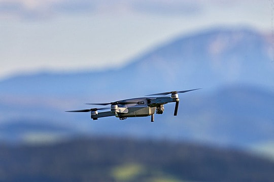
Skydio X2D Military Reconnaissance Drone: Comprehensive Review of Dual-Sensor Thermal Imaging, Encrypted Tactical Comms, and Autonomous Scouting
Global Skydio X2D Military Reconnaissance Review

Skydio X2D Military Reconnaissance Drone: Comprehensive Review of Dual-Sensor Thermal Imaging, Encrypted Tactical Comms, and Autonomous Scouting

Engineered specifically to meet the demanding requirements of defense forces and tactical military units, the Skydio X2D represents a breakthrough in autonomous reconnaissance and battlefield situational awareness. Designed to provide squad-level infantry units with immediate eyes-on-target intelligence without requiring specialized pilot training, the X2D combines rugged military-grade construction with advanced artificial intelligence and dual optical-thermal imaging payloads, ensuring decisive tactical superiority in contested environments. From a technical and mechanical design standpoint, the aircraft features a foldable, lightweight magnesium-alloy and carbon-fiber airframe designed to withstand harsh field environments and rapid deployment from tactical rucksacks. The sensor suite includes a high-resolution 4K color camera and a 320x256 FLIR thermal sensor, enabling day and night operations with equal clarity. Driven by Skydio's proprietary autonomy software engine, the drone utilizes a 360-degree computer vision navigation system that allows it to fly autonomously through dense forests, complex urban ruins, and subterranean complexes without relying on GPS navigation signals, effectively neutralizing electronic jamming and spoofing threats. The global defense marketplace supporting tactical unmanned aerial systems is experiencing robust procurement growth, driven by escalating geopolitical security challenges and the proven combat effectiveness of small reconnaissance drones. Defense market analysts evaluate autonomous flight capability as a vital lifesaver that reduces cognitive stress on soldiers and eliminates blind spots during active engagement operations. in parallel with rigorous military-standard testing, engineering teams maintain stringent cryptographic security standards for data links and storage to prevent sensitive operational footage from falling into adversary hands. Developer commitment to intuitive ground control interfaces ensures that frontline operators can master deployment and autonomous scouting routes within minutes of instruction. Compliance officers verify that defense contracting guidelines and export control regulations are strictly adhered to in every deployment. For military and defense organizations seeking reliable tactical intelligence, integrating the Skydio X2D delivers an uncompromised strategic edge. Industry experts consistently recommend utilizing autonomous perimeter-search flight routines during base defense operations to ensure comprehensive thermal surveillance coverage. (Disclaimer: For reference only)
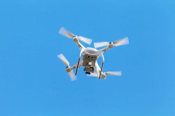
Autel Evo Max 4T Industrial Thermal Drone: Comprehensive Analysis of Autonomous Pathfinding, A-Mesh Networking, and Tri-Antenna Signal Resilience
Global Autel Evo Max 4T Industrial Review

Autel Evo Max 4T Industrial Thermal Drone: Comprehensive Analysis of Autonomous Pathfinding, A-Mesh Networking, and Tri-Antenna Signal Resilience

Establishing a formidable presence in the industrial inspection and public safety sectors, the Autel Evo Max 4T delivers a powerhouse enterprise platform packed with advanced artificial intelligence, triple-sensor imaging, and revolutionary mesh-networking communication capabilities. Engineered for search-and-rescue teams, firefighters, and energy infrastructure inspectors, the Evo Max 4T excels in complex, GPS-degraded environments where maintaining communication and situational awareness is an absolute operational necessity. From a technical and mechanical design standpoint, the aircraft features an IP43 weather-resistant airframe equipped with an advanced millimeter-wave radar and binocular vision sensor array that provides 360-degree blind-spot-free obstacle avoidance. The integrated payload housing combines a 48-megapixel zoom camera, a wide-angle optical sensor, a thermal imaging camera, and a laser rangefinder capable of measuring targets up to two kilometers away. A standout engineering innovation is the Autel Mesh networking system, which allows multiple drones and ground stations to communicate autonomously and relay encrypted data signals across mountainous or urban terrain where direct line-of-sight transmission is blocked. The commercial marketplace surrounding industrial asset auditing and emergency response has embraced the Evo Max 4T for its exceptional anti-jamming resilience and versatile payload performance. Financial market analysts note that advanced mesh communication features significantly expand operational boundaries for first responders operating in remote or disaster-stricken regions. in parallel with ongoing software development, engineering teams maintain responsive firmware pipelines that enhance AI-driven object recognition for autonomous tracking of vehicles, vessels, and human subjects. Developer dedication to data security ensures complete compliance with local data privacy mandates and secure offline storage options. Compliance officers verify that aviation safety standards and radio frequency broadcasting regulations comply strictly with regional telecom authorities. For public safety agencies requiring robust signal resilience and multi-sensor versatility, deploying the Autel Evo Max 4T provides an outstanding operational solution. Industry experts consistently recommend configuring Autel Mesh relay nodes on elevated terrain features prior to launching extended search missions in deep river valleys. (Disclaimer: For reference only)
Parrot Anafi USA Government and Industrial Drone: Comprehensive Review of Secure French Engineering, Encrypted Data Standards, and Zoom Inspection Capabilities
Global Parrot Anafi USA Review

Parrot Anafi USA Government and Industrial Drone: Comprehensive Review of Secure French Engineering, Encrypted Data Standards, and Zoom Inspection Capabilities

Designed to address the rigorous security, data privacy, and manufacturing transparency demands of government agencies, defense units, and industrial inspectors, the Parrot Anafi USA stands out as a premier secure drone platform. Developed and manufactured with an emphasis on European data protection standards and cyber resilience, the Anafi USA provides professional operators with a highly portable, rapid-deployment tool equipped with exceptional optical zoom performance and uncompromising cybersecurity protocols. From a technical and mechanical design standpoint, the aircraft features a lightweight, foldable airframe equipped with an IP53 weather-resistance rating and an advanced dual-sensor camera payload featuring a 32x digital zoom paired with a FLIR thermal imaging sensor. This high-magnification capability allows inspectors and public safety officers to maintain safe standoff distances of up to two kilometers while examining microscopic structural defects on bridges or identifying thermal anomalies on electrical substations. Data security is paramount: all recorded flight logs and media files are securely encrypted using robust cryptographic algorithms, and users retain absolute control over whether their flight data is shared via cloud services. The commercial and government marketplace supporting secure enterprise drone technology has positioned the Anafi USA as a trusted alternative for organizations restricted by federal procurement mandates regarding foreign-manufactured hardware. Industry financial analysts evaluate secure European manufacturing as a vital stabilizing factor for enterprise supply chains. in parallel with ongoing software optimization, engineering teams maintain dedicated cybersecurity update channels to safeguard against emerging digital vulnerabilities. Developer commitment to an open software development kit (SDK) allows enterprise clients to integrate custom mission planning applications seamlessly. Compliance officers verify that all regional data protection regulations and federal aviation guidelines are rigorously met. For government agencies and security-conscious enterprises seeking reliable zoom inspection capabilities, deploying the Parrot Anafi USA delivers an ideal strategic solution. Industry experts consistently recommend utilizing the 32x zoom payload during bridge infrastructure audits to inspect critical bearing joints without requiring costly lane closures. (Disclaimer: For reference only)
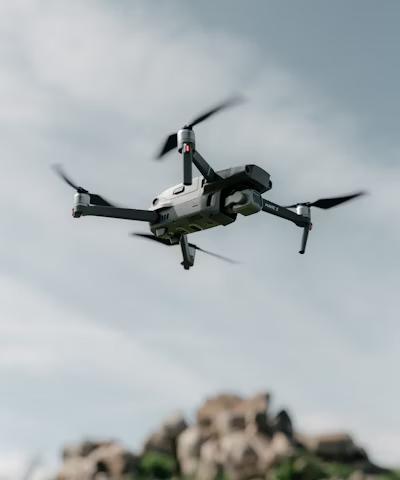
Quantum-Systems Trinity Pro Mapping Drone: Comprehensive Analysis of Vertical Takeoff VTOL Efficiency, Long-Range Photogrammetry, and AI Data Processing
Global Quantum-Systems Trinity Pro Mapping Review

Quantum-Systems Trinity Pro Mapping Drone: Comprehensive Analysis of Vertical Takeoff VTOL Efficiency, Long-Range Photogrammetry, and AI Data Processing

Revolutionizing the economics of large-scale aerial surveying, corridor mapping, and agricultural monitoring, the Quantum-Systems Trinity Pro represents the pinnacle of fixed-wing vertical takeoff and landing (VTOL) drone engineering. Engineered for professional geospatial surveyors and large agricultural enterprises, the Trinity Pro combines the aerodynamic efficiency and extended flight endurance of a fixed-wing aircraft with the operational convenience of vertical takeoff and landing, eliminating the need for runway infrastructure or catapult launch systems. From a technical and mechanical design standpoint, the aircraft features a sleek carbon-fiber composite airframe powered by an electric vertical lift rotor system combined with a high-efficiency pusher propeller for forward cruise flight. This hybrid configuration delivers an astonishing flight endurance of up to 90 minutes on a single battery charge, allowing mapping crews to cover vast tracts of land—up to 700 hectares in a single flight mission. The payload bay supports high-resolution RGB mapping cameras and multi-spectral sensors, while the onboard AI-driven landing system ensures precise, automated touchdowns even in constrained field conditions. Advanced PPK (Post-Processed Kinematic) integration guarantees centimeter-accurate georeferencing for professional GIS data generation. The commercial marketplace supporting civil engineering, mining, and large-scale cartography has widely adopted VTOL mapping drones as indispensable capital assets that drastically reduce field survey timelines and labor overhead compared to traditional ground methods. Financial analysts project continued robust market demand driven by global infrastructure development and digital twin initiatives. in parallel with ongoing software development, engineering teams maintain seamless integration with QBase 3D mission planning software and cloud-based photogrammetry processing pipelines. Developer commitment to data accuracy includes automated quality control checks that flag blurred images or insufficient overlap before the aircraft leaves the site. Compliance officers verify that civil aviation authority regulations regarding BVLOS (Beyond Visual Line of Sight) testing and VTOL operations comply strictly with international standards. For surveying enterprises seeking maximum geographic coverage and uncompromised data accuracy, deploying the Quantum-Systems Trinity Pro provides an unmatched operational capability. Industry experts consistently recommend establishing permanent ground control point networks prior to executing extensive multi-flight mapping campaigns to ensure absolute geodetic precision. (Disclaimer: For reference only)
WingtraOne GEN II Fixed-Wing VTOL Survey Drone: Comprehensive Review of High-Resolution Photogrammetry, Oblique Mapping, and Industrial GIS Accuracy
Global WingtraOne GEN II Survey Review

WingtraOne GEN II Fixed-Wing VTOL Survey Drone: Comprehensive Review of High-Resolution Photogrammetry, Oblique Mapping, and Industrial GIS Accuracy

Setting the gold standard for high-precision aerial surveying and industrial photogrammetry, the WingtraOne GEN II emerges as an advanced fixed-wing VTOL drone engineered specifically for mapping professionals who demand absolute data accuracy across massive geographic extents. Designed to bridge the gap between traditional multirotors and crewed survey aircraft, the WingtraOne GEN II combines vertical takeoff convenience with high-speed fixed-wing flight efficiency, delivering survey-grade results for mining operations, civil construction projects, and large-scale urban planning initiatives. From a technical and mechanical design standpoint, the aircraft features a distinctive tail-sitter VTOL architecture that transitions smoothly from vertical hover to horizontal wing-borne flight. This aerodynamic design minimizes drag and enables flight durations up to 59 minutes, allowing operators to map up to 400 hectares per flight at a ground sample distance (GSD) as fine as 0.7 cm per pixel. The payload ecosystem features industry-leading high-resolution cameras such as the Sony RX1R II full-frame sensor, ensuring exceptional clarity and accurate color representation. Integrated PPK technology guarantees absolute horizontal and vertical accuracy down to one centimeter without requiring extensive ground control networks. The commercial marketplace surrounding mining volumetric analysis, construction progress tracking, and GIS mapping has embraced the WingtraOne GEN II as an essential high-productivity tool. Financial market analysts evaluate fixed-wing VTOL systems as superior investments for large surveying firms seeking to maximize daily data collection output while minimizing operational labor costs. in parallel with ongoing software refinement, engineering teams maintain robust cloud-based data processing workflows that interface seamlessly with leading GIS and CAD software suites. Developer dedication to operational reliability includes comprehensive pre-flight sensor checks and automated wind-envelope safety locks. Compliance officers verify that aviation safety standards and regional airspace compliance protocols are rigorously integrated into every mission profile. For geospatial surveying enterprises requiring survey-grade data across expansive terrains, deploying the WingtraOne GEN II delivers an unbeatable professional advantage. Industry experts consistently recommend scheduling flights during optimal solar noon windows to minimize harsh shadows and ensure uniform illumination across large photogrammetric datasets. (Disclaimer: For reference only)
Textron Systems, Inc. Aerosonde Squall Hybrid VTOL: Comprehensive Analysis of Military Tactical Surveillance, Heavy-Duty Maritime Reconnaissance, and Endurance
Global Textron Aerosonde Squall Review

Textron Systems, Inc. Aerosonde Squall Hybrid VTOL: Comprehensive Analysis of Military Tactical Surveillance, Heavy-Duty Maritime Reconnaissance, and Endurance

Pioneering the frontier of tactical military surveillance and maritime intelligence, the Textron Systems Aerosonde Squall Hybrid VTOL represents a rugged, military-grade uncrewed aircraft system engineered for demanding expeditionary operations. Designed to provide uninterrupted intelligence, surveillance, and reconnaissance (ISR) capabilities for defense forces and coastal border patrol agencies across land and naval environments, the Aerosonde combines runway independence with exceptional long-endurance flight performance. From a technical and mechanical design standpoint, the aircraft features a robust, marinized composite airframe incorporating a hybrid VTOL propulsion system that enables vertical launch and recovery from small naval vessel flight decks or confined terrestrial clearings, followed by high-efficiency fixed-wing cruising. The modular payload bay supports dual electro-optical and infrared (EO/IR) sensor turrets, communications relay packages, and electronic warfare modules, ensuring versatile mission adaptability in contested operational theaters. Powered by a heavy-fuel propulsion engine, the Aerosonde delivers multi-hour flight endurance and operates reliably in extreme marine weather conditions characterized by high humidity, salt spray, and turbulent coastal wind profiles. The global defense marketplace supporting tactical uncrewed maritime systems is experiencing strong, sustained procurement demand as naval forces prioritize persistent offshore surveillance and force protection capabilities. Defense analysts evaluate hybrid VTOL tactical drones as critical assets that enhance maritime domain awareness without the logistical footprint of crewed aircraft carriers. in parallel with rigorous military flight qualification testing, engineering teams maintain secure, encrypted tactical data links resistant to electronic signal jamming. Developer dedication to fault-tolerant avionics ensures high reliability during extended maritime patrol missions. Compliance officers verify that international defense standards and military airworthiness certifications are rigorously satisfied. For defense agencies seeking persistent surveillance and runway-independent deployment, integrating the Aerosonde Squall delivers a decisive operational advantage. Industry experts consistently recommend conducting comprehensive salt-corrosion maintenance routines following naval deployment cycles to preserve airframe structural integrity. (Disclaimer: For reference only)
Insitu ScanEagle 3 Uncrewed Maritime Reconnaissance System: Comprehensive Review of Catapult-Launched Surveillance, Long-Endurance Patrols, and Sensor Payload Adaptability
Global Insitu ScanEagle 3 Review

Insitu ScanEagle 3 Uncrewed Maritime Reconnaissance System: Comprehensive Review of Catapult-Launched Surveillance, Long-Endurance Patrols, and Sensor Payload Adaptability

Serving as a veteran workhorse in long-endurance tactical reconnaissance, the Insitu ScanEagle 3 continues to define excellence in uncrewed maritime and terrestrial surveillance. Engineered for naval security forces, coast guards, and environmental monitoring agencies, the ScanEagle 3 provides persistent intelligence, surveillance, and reconnaissance (ISR) coverage over vast open-ocean expanses and remote border corridors where traditional runway-dependent aircraft cannot operate. From a technical and mechanical design standpoint, the aircraft features a lightweight, aerodynamic fuselage launched via a pneumatic catapult system and recovered securely using Insitu's patented SkyHook cable-catching technology, enabling shipboard operations without requiring traditional runway infrastructure. The upgraded ScanEagle 3 features increased payload capacity, supporting advanced multi-sensor turrets that combine high-definition electro-optical cameras, cooled infrared thermal imagers, and automated identification systems (AIS) for tracking maritime vessels. Powered by a reliable heavy-fuel EFI engine, the platform delivers exceptional flight endurance exceeding 16 hours, ensuring round-the-clock operational coverage. The commercial and defense marketplace supporting maritime security and border surveillance values the ScanEagle platform for its proven reliability and cost-effective operational footprint. Defense market analysts note that long-endurance catapult-launched systems offer vital strategic persistence for naval task forces operating far from established land bases. in parallel with ongoing software enhancements, engineering teams maintain secure ground control station interfaces that integrate real-time sensor feeds with maritime tracking databases. Developer dedication to aerodynamic efficiency ensures stable flight performance even in gale-force winds and turbulent marine atmospheric conditions. Compliance officers verify that international maritime navigation rules and aviation safety standards are strictly respected during operations. For defense and security agencies requiring persistent overhead surveillance, deploying the Insitu ScanEagle 3 provides an uncompromised operational capability. Industry experts consistently recommend practicing SkyHook recovery procedures in simulator environments to maintain flight crew proficiency during demanding sea-state operations. (Disclaimer: For reference only)
General Atomics MQ-9B SkyGuardian Medium-Altitude Long-Endurance Drone: Comprehensive Analysis of Global Civil Airspace Integration, Satcom Control, and Strategic ISR
Global General Atomics MQ-9B SkyGuardian Review

General Atomics MQ-9B SkyGuardian Medium-Altitude Long-Endurance Drone: Comprehensive Analysis of Global Civil Airspace Integration, Satcom Control, and Strategic ISR

Representing the pinnacle of strategic medium-altitude long-endurance (MALE) uncrewed aviation, the General Atomics MQ-9B SkyGuardian stands as a revolutionary remotely piloted aircraft system designed to execute relentless intelligence, surveillance, reconnaissance (ISR), and humanitarian support missions across global civil and military airspaces. Engineered to meet strict international airworthiness certification standards, the SkyGuardian bridges the operational gap between military combat fleets and civilian airspace integration. From a technical and mechanical design standpoint, the aircraft features a high-aspect-ratio 24-meter wingspan powered by a reliable turboprop engine, delivering an astonishing flight endurance exceeding 40 hours at altitudes up to 40,000 feet. The aircraft is equipped with advanced satellite communications (SATCOM) data links for global command and control, comprehensive multi-mode maritime surface search radars, electronic intelligence sensors, and high-definition electro-optical infrared (EO/IR) targeting turrets. Crucially, the SkyGuardian features a certified Detect and Avoid (DAA) system comprising air-to-air radar and traffic collision avoidance algorithms, enabling safe routine flight operations within non-segregated national and international civil airspaces. The global defense and governmental marketplace supporting strategic intelligence gathering and disaster relief views the MQ-9B as an indispensable multi-role asset. Defense market analysts highlight the aircraft's certified civil airspace integration as a monumental regulatory milestone that unlocks domestic search-and-rescue and border security applications. in parallel with continuous software and avionics upgrades, engineering teams maintain robust ground control station architectures that streamline operator workload during multi-day missions. Developer commitment to structural durability ensures compliance with severe weather icing and lightning strike protection standards. Compliance officers verify that military export controls and civil aviation authority approvals are meticulously managed. For defense ministries and national security agencies seeking global operational reach, deploying the MQ-9B SkyGuardian delivers unmatched strategic capability. Industry experts consistently recommend coordinating closely with regional air traffic control authorities prior to initiating trans-oceanic transit flights. (Disclaimer: For reference only)
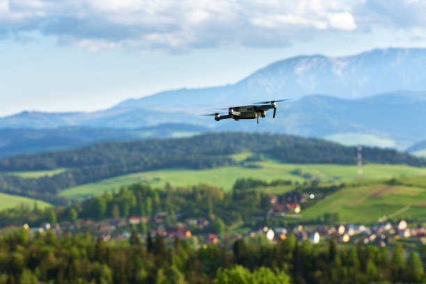
Baykar Bayraktar TB3 Carrier-Capable Armed Reconnaissance Drone: Comprehensive Review of Folding Wings, Short-Deck Naval Operations, and Long-Endurance Combat Air Patrol
Global Baykar Bayraktar TB3 Naval Review

Baykar Bayraktar TB3 Carrier-Capable Armed Reconnaissance Drone: Comprehensive Review of Folding Wings, Short-Deck Naval Operations, and Long-Endurance Combat Air Patrol

Pioneering a revolutionary naval aviation capability for uncrewed combat aerial systems, the Baykar Bayraktar TB3 emerges as a sophisticated, folding-wing armed reconnaissance drone specifically engineered to operate from short-deck amphibious assault ships and aircraft carriers. Expanding upon the proven combat legacy of its land-based predecessor, the TB3 introduces advanced folding wing mechanisms, increased payload capacity, and robust satellite communications, transforming naval power projection for modern defense forces. From a technical and mechanical design standpoint, the aircraft features a lightweight composite airframe with hydraulically folding outer wings that minimize deck footprint storage requirements aboard naval vessels. Powered by a reliable domestic turbodiesel engine, the TB3 delivers exceptional flight endurance exceeding 24 hours, allowing continuous Combat Air Patrol (CAP) and over-the-horizon targeting missions. The under-wing hardpoints support a versatile array of precision-guided munitions, laser-designated smart micro-munitions, and multi-spectral reconnaissance sensor pods, giving naval commanders immediate strike and surveillance capabilities in contested maritime theaters. Advanced beyond-line-of-sight (BLOS) satellite communication links ensure uninterrupted control regardless of operational distance from naval carrier strike groups. The global defense marketplace surrounding naval uncrewed combat systems is experiencing explosive expansion, as naval strategists recognize the cost-effectiveness and tactical flexibility of carrier-launched drones. Defense market analysts evaluate the Bayraktar TB3 as a paradigm-shifting asset that endows nations without massive CATOBAR carriers with potent naval air power. in parallel with ongoing avionics refinement, engineering teams maintain rigorous salt-fog and corrosion-resistance testing protocols to ensure structural longevity in harsh marine environments. Developer commitment to autonomous takeoff and landing algorithms simplifies shipboard recovery procedures. Compliance officers verify that international defense export controls and military airworthiness standards are strictly satisfied. For defense forces seeking naval aviation enhancement, integrating the Bayraktar TB3 provides an unmatched strategic advantage. Industry experts consistently recommend conducting comprehensive deck-motion simulation tests prior to executing initial shipboard launch and recovery trials. (Disclaimer: For reference only)
AeroVironment Switchblade 600 Loitering Munition: Comprehensive Analysis of Precision Armor Piercing, Long-Range Tactical Strike, and Rapid Deployment
Global AeroVironment Switchblade 600 Review

AeroVironment Switchblade 600 Loitering Munition: Comprehensive Analysis of Precision Armor Piercing, Long-Range Tactical Strike, and Rapid Deployment

Setting the benchmark for tactical precision-guided loitering munitions, the AeroVironment Switchblade 600 is engineered to deliver decisive anti-armor and anti-materiel strike capabilities for elite ground forces. Designed for rapid, tube-launched deployment by small infantry teams or armored vehicle crews, the Switchblade 600 combines extended loitering endurance with a high-precision anti-armor warhead, neutralizing high-value hardened targets at significant operational stand-off distances without requiring external reconnaissance support. From a technical and mechanical design standpoint, the weapon system features a compact, man-portable transport container that houses a foldable-wing electric aircraft powered by a quiet brushless motor. The integrated guidance architecture combines high-definition electro-optical and infrared (EO/IR) gimbaled sensors with advanced proprietary tracking algorithms, allowing operators to acquire, track, and engage moving or stationary targets with pinpoint accuracy. The advanced warhead design is optimized to defeat modern heavy armor and fortified field positions. An intuitive tablet-based ground control station enables rapid mission planning, real-time video streaming, and manual wave-off capabilities right up to the final moment of impact to prevent collateral damage. The global defense marketplace supporting precision tactical strike munitions has experienced massive procurement acceleration, driven by the critical need for cost-effective, high-precision weapons capable of countering heavily armored threats in contested environments. Defense analysts evaluate loitering munitions as essential force multipliers that bridge the operational gap between traditional artillery fire and crewed aviation. in parallel with ongoing software hardening, engineering teams maintain secure, encrypted data links resistant to advanced electronic warfare jamming and signal spoofing. Developer dedication to rapid operator training ensures that frontline soldiers can master field setup and launch procedures in minutes. Compliance officers verify that defense contracting standards and export control regulations are rigorously met. For military units seeking decisive tactical precision, integrating the AeroVironment Switchblade 600 delivers an unbeatable operational advantage. Industry experts consistently recommend practicing simulated target engagement routines to maintain high operator proficiency during high-stress operational scenarios. (Disclaimer: For reference only)
Kratos XQ-58A Valkyrie Low-Cost Attributable Aircraft: Comprehensive Review of Loyal Wingman Integration, Stealth Geometries, and Autonomous Combat
Global Kratos XQ-58A Valkyrie Review

Kratos XQ-58A Valkyrie Low-Cost Attributable Aircraft: Comprehensive Review of Loyal Wingman Integration, Stealth Geometries, and Autonomous Combat

Pioneering the future of affordable mass and cooperative combat aircraft technology, the Kratos XQ-58A Valkyrie represents a revolutionary leap forward in low-cost attributable aircraft (LCAA) engineering. Designed to operate alongside crewed fifth- and sixth-generation fighter jets as a loyal wingman, the Valkyrie provides military air forces with high-performance stealth capability, electronic warfare delivery, and tactical strike options at a fraction of the cost of traditional tactical aircraft. From a technical and mechanical design standpoint, the aircraft features an advanced aerodynamic stealth airframe constructed from composite materials, featuring a swept wing, a V-tail, and an internal weapons bay capable of carrying precision-guided munitions or surveillance payloads. Powered by a high-efficiency turbofan engine, the Valkyrie achieves high subsonic cruise speeds and extended operational ranges exceeding 3,000 nautical miles. Crucially, the aircraft is designed for runway-independent operations using a rocket-assisted takeoff and parachute recovery system, allowing deployment from dispersed austere locations without requiring established airbases. The global defense marketplace surrounding collaborative combat aircraft is undergoing an explosive transformation as air forces prioritize high-volume, cost-effective force structures to counter modern adversary air defense networks. Defense market analysts evaluate attributable aircraft as essential strategic disruptors that protect high-value pilot lives and expensive fighter jets during high-risk missions. in parallel with continuous software and flight autonomy advancements, engineering teams maintain open-systems architecture compliance, allowing seamless integration with diverse military command networks and third-party AI pilot algorithms. Developer dedication to rapid manufacturing workflows ensures scalable production capabilities. Compliance officers verify that international defense export controls and military flight airworthiness standards are strictly satisfied. For defense agencies seeking next-generation tactical air power expansion, integrating the Kratos XQ-58A Valkyrie delivers an unmatched strategic capability. Industry experts consistently recommend conducting extensive digital twin flight simulations prior to executing complex multi-aircraft swarm maneuvers. (Disclaimer: For reference only)
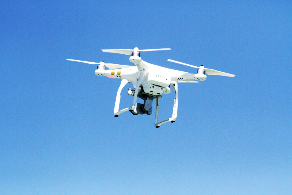
View all 40 articles →
📝
40
Articles
🌐
40
Sources
🔄
Daily
Updates
👥
10K+
Readers

Popular Topics

Explore trending articles and discover new content